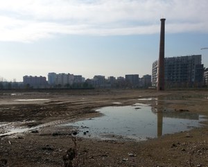
Soil consumption of Roma Capitale
Roma, 17 january
The Statistics Unit - Open Data of Roma Capitale, together with ISPRA, carried out in the course of 2018 a project within the Civil Service on the theme of land use, with specific attention to the areas subject to hydrogeological risk. Project that was also included in the current National Statistical Plan with ISPRA and ISTAT partners. This research has allowed to develop a more detailed mapping of land use thanks to the interpretation of satellite images (scale 1: 2000-1: 5000), integrated with data from Urban Atlas (2016), Open street Map and CTR of Rome, using the III level of classification of the mapping of the consumption of national soil
- https://www.isprambiente.gov.it/en/archive/news-and-other-events/ispra-news/2019/01/soil-consumption-of-roma-capitale
- Soil consumption of Roma Capitale
- 2019-01-17T09:30:00+00:00
- 2019-01-17T13:30:00+00:00
- Roma, 17 january The Statistics Unit - Open Data of Roma Capitale, together with ISPRA, carried out in the course of 2018 a project within the Civil Service on the theme of land use, with specific attention to the areas subject to hydrogeological risk. Project that was also included in the current National Statistical Plan with ISPRA and ISTAT partners. This research has allowed to develop a more detailed mapping of land use thanks to the interpretation of satellite images (scale 1: 2000-1: 5000), integrated with data from Urban Atlas (2016), Open street Map and CTR of Rome, using the III level of classification of the mapping of the consumption of national soil
- When Jan 17, 2019 from 09:30 AM to 01:30 PM (GMT+0 / UTC0)
- Where Rome
-
Add event to calendar
iCal
At the conference will partecipate the ISPRA President Stefano Laporta and some ISPRA experts.

