GeolIT3D three dimensional modelling and visualization of geological data
The Italian Geological Survey has expanded its institutional activities of data collection and dissemination promoting a project of 3D geological modelling and visualization.
Several 3D models have been built in different geological domains, ranging from the Apenninic fold and thrust belt to the alluvial plains of the Tevere River, to test the full applicability of the CARG database and other geological database. The three-dimensional modeling techniques have been applied to a variety of geological areas, at various scales, to achieve different purposes.
| 3D Models | Geological domain | Area (km2) |
Depth (m) |
Data surface | Data subsurface | Purpose |
|---|---|---|---|---|---|---|
| Fossombrone | Northern Apennines | 600 | 3500 | Field data (1:10,000) Attitude data |
Cross-sections |
3D representation geologica sheet |
| Firenze | Alluvial plain | 25 | 100 | Cross-section Well stratigraphies Dedrock isobaths map |
Analysis of rock volumes | |
| Polino | Central Apennines | 18 | 400 | Field data(1:10,000) | Cross-sections | Paleogeographic reconstruction |
| Cimini | Volcanic area | 250 | 3000 | Field data(1:10,000) | Well stratigraphies Bedrock isobath map |
Hydrogeological complexes |
| Vette Feltrine | Southern Alps | 300 | 2500 | Field data(1:10.000) Attitude data |
Cross sections | Structural restoration |
| Plio-pleistocenic clays | Adriatic foredeep | 50,450 | 4,100 | - | Deep well stratigraphies | Analysis of rock volumes |
| Fiumicino | Deltaic area | 80 | 100 | Field data (1:10,000) | Deep well stratigraphies | 3D representation subsoil geological sheet |
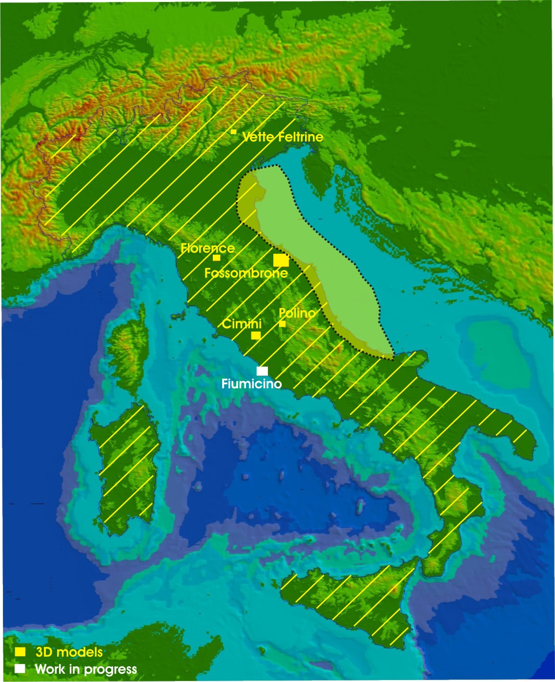 At he moment the construction of the 3d model of the geological sheet Fiumicino is in progress.
The final objective of this work is to share 3D data and models with end-users via the Internet (D'Ambrogi et alii, 2010).
| 3D spatial data | number |
| Deep wells | 1,394 |
Deep Sea Drilling Project/Ocean Drilling wells Project |
19 |
| [number] (km) | |
| CROP Project - interpreted sections | [4] (776) |
| number | |
| CSI-earthquake hypocentres | 38,529 |
| max depth/equidistance value | |
| Base of Pliocene isobaths map | 9 km/500 m |
| Moho isobath maps | 56 km/2 km |
| Lithosphere thickness map | 130 km/20 km |
| cell size (degree) | |
| Lithosphere-astenosphere system | 1°x1° |
| other spatial data | [number] (length km) |
| CROP Project - seisemic lines on-shore TWT | [17] (1,254) |
| CROP Project - seisemic lines off-shore TWT | [46] (8,740) |
| number of measurement points | |
| Heat flow | 2,700 |
| Gravity anomalies | 277,863 on-shore 80,288 off-shore |