Fiumicino geological sheet at the scale 1:50.000
Geological sheet no. 386 “Fiumicino” is currently being prepared. The part related to the sea area is being realized according to an agreement between the National Geological Survey and the Lazio Region. The part related to the land area is being realized directly by the Geological Survey of Italy, Land Protection and Georesources Department, in collaboration with “La Sapienza” University of Rome and the Geological Survey of the Province of Rome (for aspects concerning applied geology).
Sea area
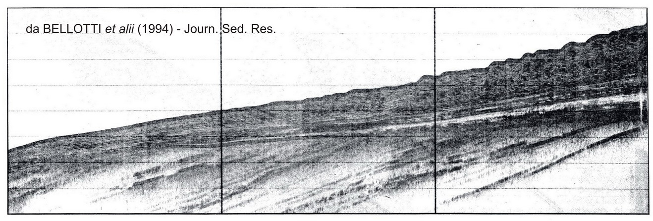
This area of the Sheet includes the Tiber delta sedimentary sequence that was deposited on top of the Würmian erosional surface during the last glacial cycle.
The Sheet’s realization comprises the cartographic representation of about 1,400 km of seismic records and bed samples collected (with gravity bucket and core barrel) over the last 20 years by “La Sapienza” University of Rome. The bathymetry was supplied by the Navy Hydrographic Institute (Istituto Idrografico della Marina), with adequate details for this type of study. Among other things, this enabled the relocation of old seismic data that was adjusted according to more precise parameters offered by the current sea station systems.
Sea maps were prepared according to rules provided by the “New guidelines for the mapping of marine areas on a scale of 1:50,000”. They represent the various sub-environments deposited under the delta and their interaction with the external and slope platform morphology and sedimentation.
The good penetration of the seismic signal in these types of sediments (except in limited areas where there are coarser deposits or gas pockets) enables a geometric reconstruction of the post-glacial deposit sequence of the area with a high vertical resolution.
The application of sequential stratigraphy concepts, facilitated by three-dimensional methods of analysis, enables the successful matching of the geology of emerged and submerged areas, showing their evolution in time.
Land area
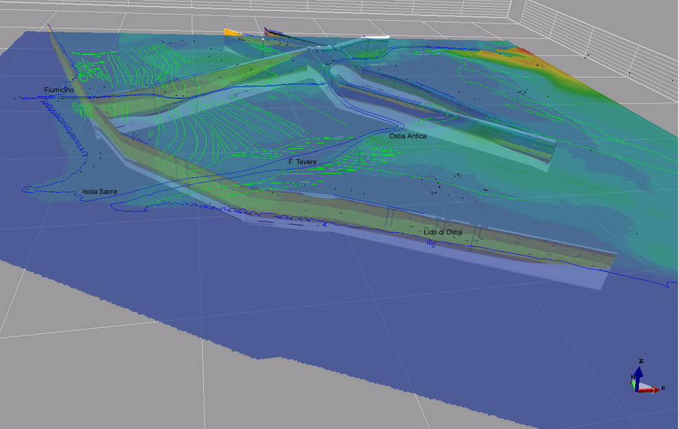
This area of the Sheet has many points of interest related to the presence of the Tiber River delta. Due to its relevance and extension, it is the most important delta area in Italy after the Po River delta. It also has large, highly anthropized areas. Indeed, this area of the Sheet includes: the southern part of the “Leonardo da Vinci” international airport; the inhabited areas of Lido di Ostia and Fiumicino; several densely constructed areas and the archaeological areas of Ostia Antica, the Necropolis of Porto and the Traiano Port, covering almost 50% of the total area.
 These particular features required intense data collection activities, which were carried out during the mapping campaign (on a scale of 1:10,000). Samples were collected for granulometric analyses (carried out at the laboratories of ISPRA’s Land Protection and Georesources Department). It became, above all, necessary to integrate normal mappings with an analysis of aerial photographs and an acquisition of survey stratigraphies (126 have been collected until today).
A geological interpretation was made of aerial photographs of Italy and of photograms realized by the Royal Air Force (RAF) during the war, between 1943 and 1944. The latter revealed to be very useful, since they referred to periods in which anthropization was still very limited and was only a partial hindrance to the interpretation of morphological elements.
This analysis led to the identification and mapping of different dune bar systems and their variation in time, marking the different evolutionary stages of both the coastal area and the shore.
The activity of collecting mapping stratigraphies, realized or collected by public (ISPRA, Provinces, Regions, Municipalities and ANAS) and private entities, is still in course. It is an essential step to deepen our knowledge on the distribution and geometry of subsurface bodies.
Mapping stratigraphies are digitalized and processed by means of specific software which merge surface and subsoil data in order to create a three-dimensional geological model of the area. This provides an improved definition of the distribution and geometry of geological bodies.
In addition, particular attention will be paid to environmental emergencies in the delta and coastal areas. These are very sensitive areas affected by phenomena such as overflowing, subsidence, existence of submerged areas, coastal erosion and possible sea-level rise, among others.