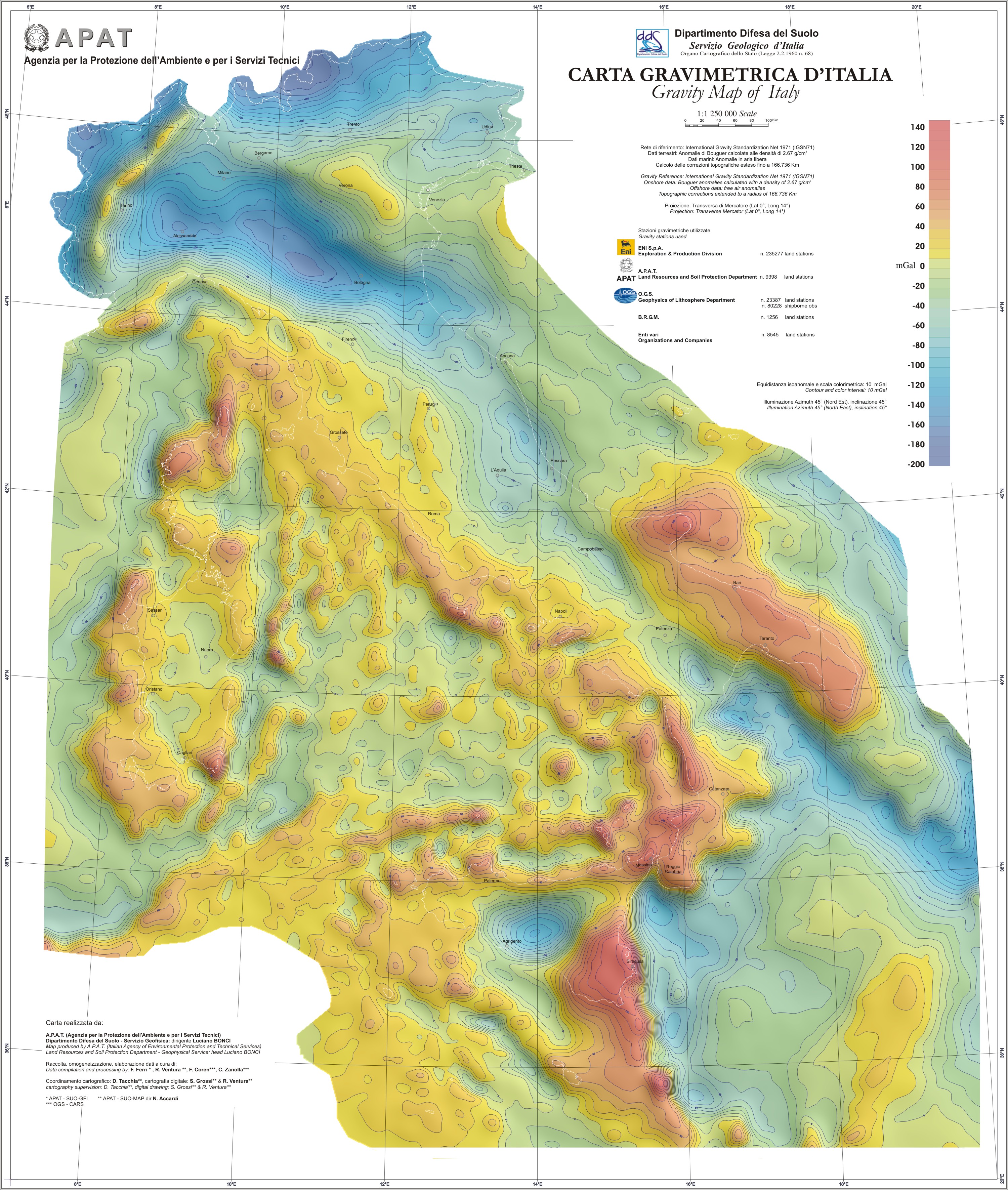
Gravimetric Map of Italy on a scale of 1:1,250,000
Gravimetric Map of Italy
A new gravimetric map of Italy and the adjacent seas was
realized on a scale of 1:1,250,000 using land and sea data
extracted respectively from databases of the ISPRA (Italian
National Institute for Environmental Protection and Research - Land
Protection and Georesources Department) and of the OGS (National
Institute of Oceanography and Experimental Geophysics –
Department of Geophysics of the Lithosphere). All data was referred
to the IGSN71 (International Gravity Standardization Net) and the
normal gravity was calculated using the 1980 formula. Land data was
processed by calculating the Bouguer anomaly using a density of
2.67 g/cm³. The topographical correction was extended to a
radius of 166,736 km from the station point. The processing of sea
data, most of which was acquired along navigation lines, only
consisted in calculating the free-air anomaly. A grid was created
by inserting gravimetric data at a regular interval of 1 Km. The
resulting map consists in this grid’s outline with a
colour-shaded relief representation.
The map contains information on medium-scale gravity anomalies for
geophysical studies related to the deep geology and the tectonic
elements of the Italian terrain. It can be considered a useful tool
for identifying the main structural features and outlining the main
geological elements on a regional scale.
Special credits go to ENI S.p.A. - Exploration & Production
Division, for having enabled us to use their gravimetric data,
which are also in the ISPRA database, and B.R.G.M. CDG/MA for
having provided onshore gravimetric data on Corsica.
For further information contact: Dr. Fernando Ferri (ISPRA-SUO-GFI)