The history of the Geological Survey of Italy
The history
The Geological Survey of Italy has been producing geological maps for over 130 years. The history of the Geological Survey, which has changed institutional setting and name several times, is inextricably linked to the history of the geological map.
The geological structure of our country has always intrigued and fascinated scholars since the Leonardo da Vinci's times. Nevertheless a precise political plan and an ongoing financial support, necessary to be included among the current leaders in the Earth Sciences, has always been missing.
In fact, even before the unification of Italy, scholars had expressed the intention of making a geological map of the Italian peninsula in analogy with what was already taking place in other European countries. But the program ran aground for lack of funds and unshared views.
The project of geological mapping was then carried out at local level, supported by the most advanced governors and only for particular areas, in order to stimulate the mining industry and the economy. With the unification of Italy, there was a need to have a large-scale topographic mapping to start the geological mapping. There was also the necessity to establish a Central Committee, in order to define the appropriate procedures to start the survey of the national territory. Besides, it was necessary to create a General Central Collection, to dispose of partial illustrated geological maps and to train the personnel to be assigned to the work of detection.
 1867 - the Geological Committee
Royal Decree No. 4113 of 15 December 1867 provides that the Geological Section of the Council of Mines is constituted as Geological Committee at the Ministry of Agriculture, Industry and Commerce, with the mandate to compile and publish the large geological map of the Kingdom of Italy and to manage the works, collecting and preserving materials and related documents.
The Committee headquarters were established in Florence. The Tuscan Igino Cocchi, supported by famous men such as Felice Giordano and Quintino Sella, was appointed President of the Geological Committee.
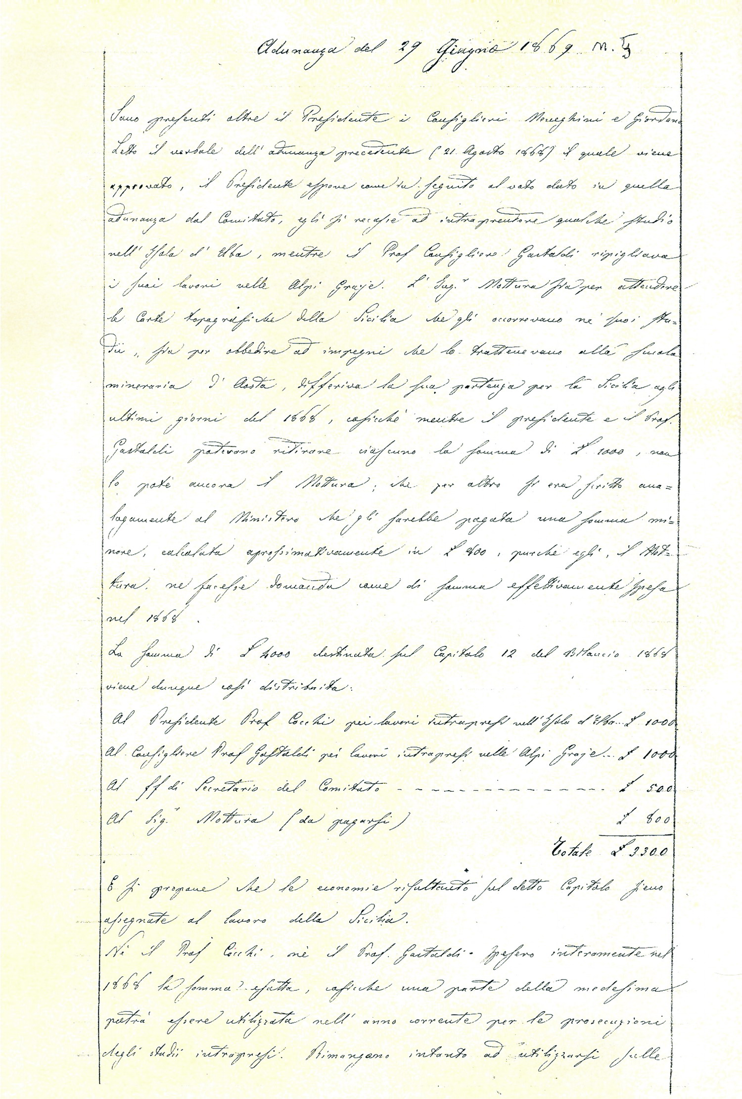 1869 - Publications
In 1869, the Geological Committee decided (meeting No. 5 of June 29, 1869) to support the cartographic production with publications such as the Bulletin and other monographs, to show the country the work that had been done and to encourage, through the scientific exchange, relations with foreign Geological Surveys.
![]() 1872 - the first geological map
1872 - the first geological map
The Geological Map of the Island of Ischia at the scale 1:25,000 is considered the first map published by the Royal Geological Committee
 1873 - The Royal Geological Office
 Royal Decree No. 1421 of 1873 defined the rules for the creation and publication of the Geological Map of Italy, entrusted to the Geological Office established at the Section of the Royal Corps of Mines in Rome, under the highest scientific direction of the Geological Committee, whose tasks, among others, is also to determine the classification of lands and to provide for the choice of colors and symbols to be used in mapping.
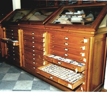
The Geological Office is endowed of a special section, specialised in the classification of minerals and rocks collected during the field work and in the collection of books, maps and tools already in use at the Geological Committee's Florence headquarters.
1877 - The first surveys for the Geological Map of Italy at the scale 1:100,000
The production of the Kingdoms's geological maps at 1:100,000 scale began with the realisation of sheets relating to areas of particular geological and mining interest. Sicily, for its economic importance due to the mineral deposits, had the highest cartographic production, with 31 sheets already realised at the end of 1891! The works of survey, carried out between 1877 and 1882, aimed to realising the map at the scale 1:500.000, adopted as index map for the map at a scale of 1:100,000. They were also aimed at producing maps on a larger scale, such as the one of the Straits of Messina, presented in Paris on the occasion of the International Geological Congress in 1878.
The survey activities did not always lead to a printed map, which therefore remained in the archives as documentation.
1877/1885 - The shift from one Ministry to another ...
As provided by Royal Decree No. 1421 of 26 December 1877, the Mines Service was located at the dependency of the Ministry of Public Works.
The Geological Committee was established at the Ministry of Agriculture, Trade and Industry (Royal Decree 4715 of January 23, 1879).
1881 - The first map at the scale 1:1.000.000
The first geological map of Italy a the scale 1:1,000,000 (in fact 1:1.111.111) was presented at the Second International Congress of Geology held in Bologna, in two sheets showing the summary of published and unpublished geological knowledge of the Italian territory.
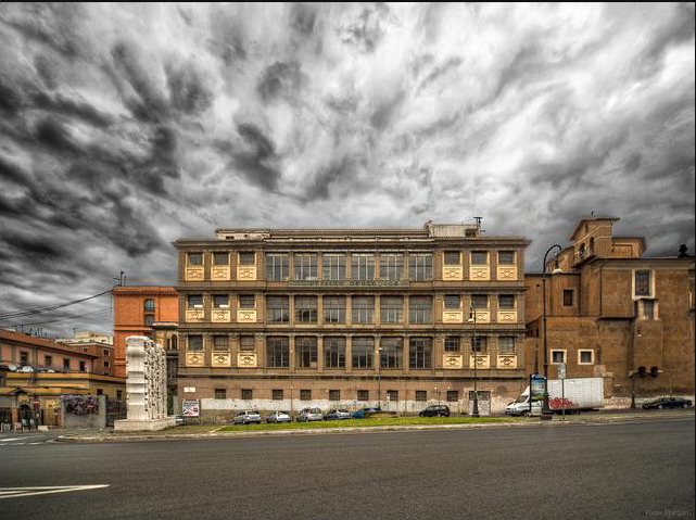 1885 - The historical headquarters
The building to house the Agricultural Geological Museum and the Royal Geological Office, designed by R. Canevari, was built in largo S. Susanna in Rome. The premises, in addition to the exhibition halls of the Paleontological and Mineralogical Collections, hosted also a Library. The Agricultural Geological Museum was inaugurated by King Umberto I in 1885.
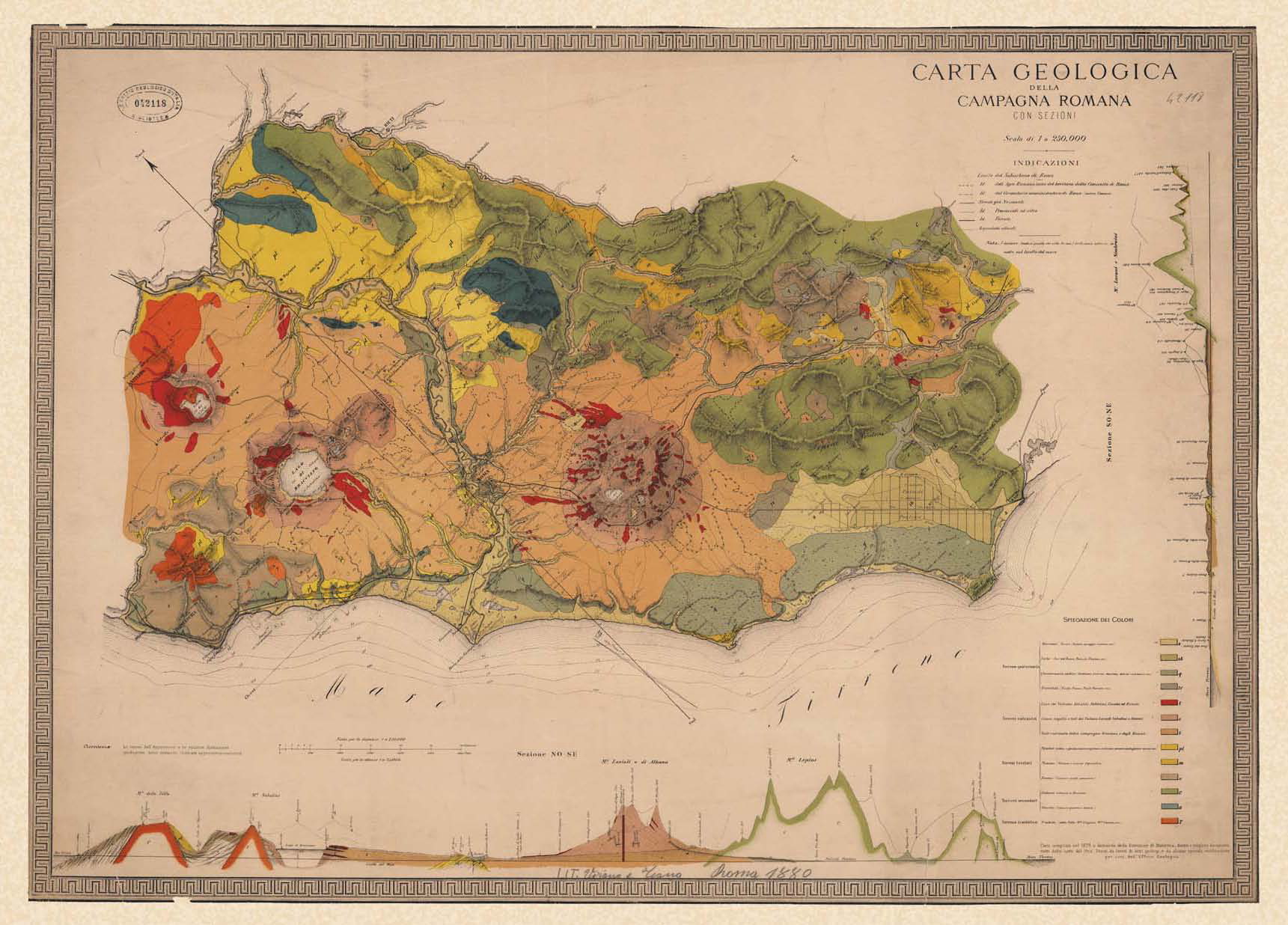 1888/1900 - Roman and Calabria's Campaing
A boost for the mapping process was given by the realisation of the geological sheets of the Roman Countryside and Calabria. The print of 23 sheets of southern Calabria at 1:50,000 scale provided a relevant documentation for an area totally devoid of the official map until then, a precious documentation for territorial planning.
1920 - Geological Office of the Directorate General of Mines
After a period of inactivity due to the advent of the First World War and to the consequent seriousness of the country's economic conditions, the works for the realisation of the geological map of Italy started again.
Royal Decree No. 19 of January 4, 1920 states the following functions for the Office of Geological Survey:
- the survey and the publication of the geological map of the kingdom, and the preparation and publication of the related illustrative studies;
- the petrographic and chemical study of minerals and rocks from the scientific point of view and in view of their possible use and the study of geological problems of practical and general interest;
- geomineralogical advice;
- the collection of Italian minerals and rocks and their arrangement in scientific collections.
 1923 - Ministry of National Economy
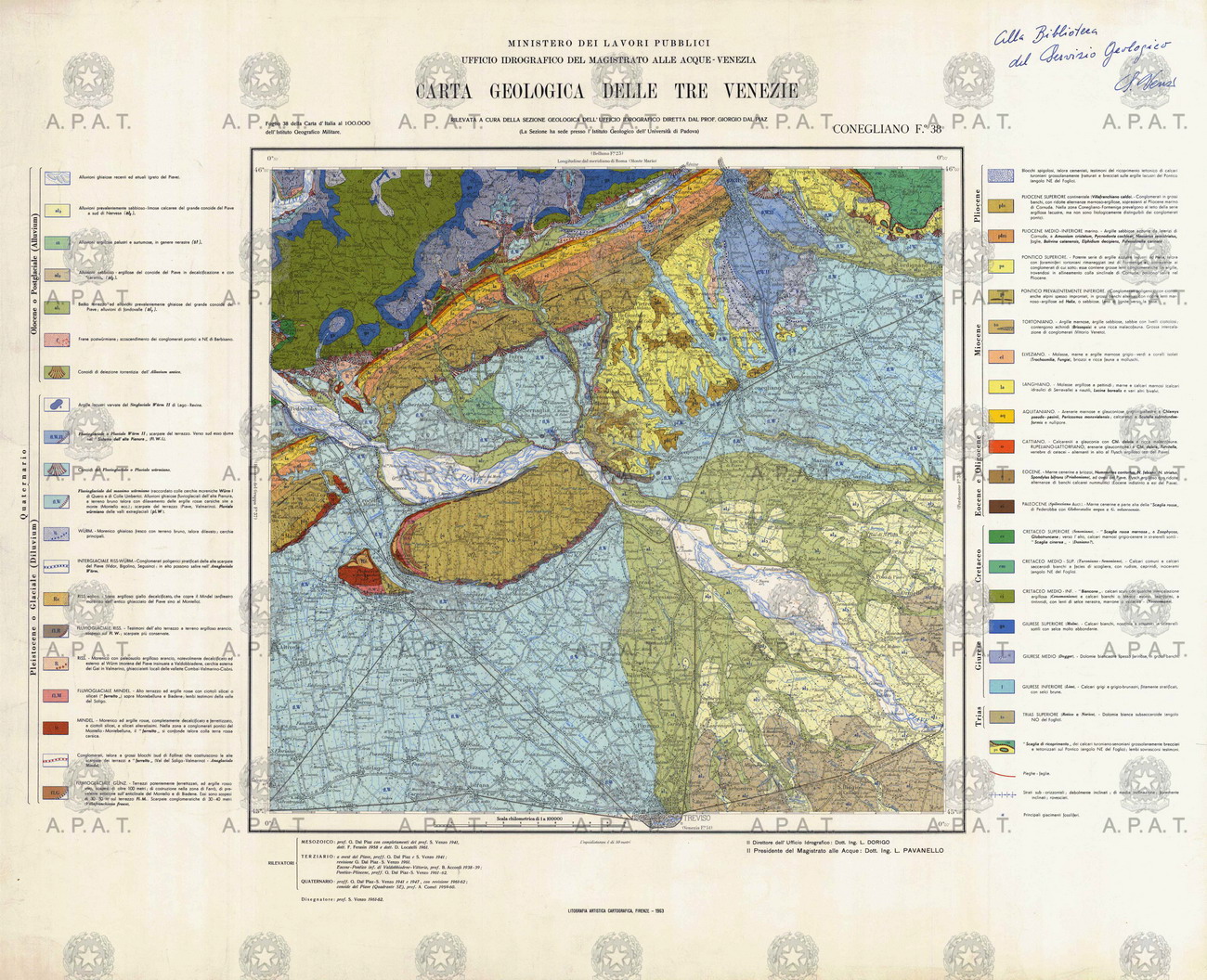
Under the constitution of the Ministry of National Economy, the Geological Office became part of the Subsoil Exploration Department of the General Division of Mines and National Fuels (Royal Decree No.2125 of September 6, 1923). The reorganization of the Geological Survey is reported in Royal Decree No.346 of February 17, 1927, where the tasks of the Geological Survey were reaffirmed. We assist to the resumption of survey and printing activities, with the cooperation of the Royal Water Authority. It was printed the Map of Tre Venezie and the relating Explanatory Notes.
1936 - Royal Corps of Mines of the Ministry of Corporations, Directorate General of the Industry
With the colonial expansion of the fascist period, the Geological Survey under the Royal Corps of Mines is strengthened and reordered by Royal Decree Law No. 237 1936/XIV of January 20 and Law of May 25, 1936/XIV.
1943 - Geological Survey of Directorate General of Mines and Metallurgy
Royal Decree of May 10, 1943 reorganized the Geological Survey, extending its tasks to the realisation of geophysical studies and researches.
With Royal Decree No.718 of August 9, 1943 the Ministry of Corporations was renamed Ministry of Industry, Trade and Work.
1958 - Geological Survey of the Corps of Mines
Decree of the President of the Republic No. 413 of January 16, 1958 defined the rules for the adjustment of the Geological Survey in the Corps of Mines.
 1960 - National Cartographic Institution
Law No.68 of February 2, 1960 designated the Geological Survey as National Institution.
Law No. 15 of January 3, 1960, also referred to as "Legge Sullo", authorized the extraordinary expenditure of 2.5 billion dollars for the completion, upgrading and publication of the Geological Map of Italy and their illustrative studies. Universities, public and private Institutions and autonomous Regions will help to complete the work by 30 June 1970, under the supervision of the Geological Committee.
1971 - Geological map at 1:50,000 scale - the work begins
Once completed the geological mapping at the scale 1:100,000, the Geological Survey began the works for the realization of the Geological Map at 1:50,000 scale. With scarce human and financial resources, only few sheets will be printed, referred to as "experimental sheets".
1987 - Geological Survey of the Ministry of Environment
Prime Minister Decree of 15 January 1987 stated to trasfer the Geological Survey to the Ministry of the Environment, with several tasks: compiling, publishing and updating the geological map and the geothematic maps at different scales, establishing collections and national databases, making researches and controls in order to investigate and protect the national territory and provide to the public administration general consultancy in the field of Earth Sciences.
Decree-Law No. 373 of 9 September 1987 373 provided for the allocation of 75 billion of Italian Lire to cope with the expansion and reorganization of the Geological Survey.
1988 - scientific and operational autonomy of the Geological Survey
The Geological Survey of Italy was given functional autonomy in the conduction of the technical activities of service and research, in order to ensure the conservation and optimum utilization of the territory (Prime Minister Decree of 15 October 28, 1988).
Under the annual Program of urgent measures for environmental protection, 20 billion of Italian Lire were allocated for the realisation of the geological mapping at 1:50,000 scale (CARG project) (Law 67/88 and CIPE Resolution).
1989 - National Geological Survey of the Presidency of the Council of Ministers
Law No. 183/89 on the soil protection established the Geological Survey, together with the Hydrographic and Mareographic Survey, Seismic and Dams, as a coordinated and united system under the presidency of the Council of Ministers, named "National Technical Services Department", with scientific, technical, organizational and operational autonomy, in order to ensure the soil conservation, the rehabilitation of waters, the use and management of water resources and the attention to the environmental aspects.
Law No. 305/89 and the relating CIPE Resolution, decided to include the activities related to the CARG project in the three-year plan for environmental protection.
Political will finally joined the economic resources availability!
The reorganization and strengthening of national technical services (Presidential Decree No 85 of January 24, 1991) established that the Geological Survey, in addition to exercising the tasks already assigned, should cooperate in the activities of civil protection for prevention purposes on the occasion of natural disasters or other major emergencies.
1999 - APAT
Legislative Decree No. 300/99, the Department for National Technical Services joins the National Agency for Environmental Protection (ANPA): the new Agency for Environmental Protection and Technical Services (APAT) was therefore created, carrying out the tasks and the scientific and technical activities of national interest for the environmental protection and water resources and soil conservation.
As a result of this new structure, and in light of the new legislation, the Geological Survey loses its historic designation and falls with its tasks within the new structure.
2008 - ISPRA
Law No. 133 of August 21, 2008 stated the merging of APAT, ICRAM (Central Institute for Scientific and Technological Research Applied to the Sea) and INFS (National Institute for Wildlife). The merging process gave life to ISPRA: National Institute for Environmental Protection and Research.
Bibliography
For further information on the Geological Survey of Italy you can consult the following publications:
SPERANDIO S. & ZANFRA' S. - (1977) - Primi programmi per la Carta geologica d'Italia. Verbali delle adunanze del Regio Comitato Geologico d'Italia negli anni 1868-1877. Documentazione originale storica, tecnica ed iconografica. Boll. Serv. Geol. d'Italia, CXIV suppl., Roma
CARUSONE A., MORRONI E. & ZANFRA' S. (1996) - La Carta geologica d'Italia. Un itinerario bibliografico. Presidenza Consiglio dei Ministri, Dip. Serv. Tec. Naz., biblioteca. IPZS, Roma
CORSI P. (2007) - Introduction to thematic set of paper on Geological Surveys. Earth Sciences History, 26 (1): 5-12
CORSI P. (2007) - Much ado about nothing: the Italian Geological Survey, 1861-2006. Earth Sciences History, 26 (1): 97-125
TACCHIA D. (2007) - Carta geologica d'Italia - 1:50.000. Guida all'uso del manuale cromatico di riferimento per la stampa delle carte geologiche. Quaderni serie III, vol. 11. APAT, Roma