Egadi Islands Marine Protected Area: the ELPIS II wreck
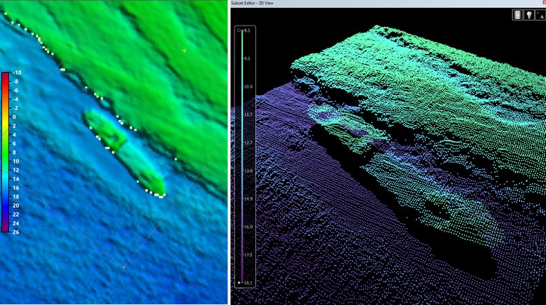
In April, during a series of aerial survey operations for the mapping and characterization of coastal habitats along the entire Italian coast at very high resolution, a new survey of the ELPIS II wreck was carried out, confirming a well-preserved and still intact structure.
The wreck had already been identified by ISPRA using underwater photogrammetry and multibeam surveys, in collaboration with the Carabinieri Subacquei units of Rome and Messina.
Sunk in 1978, the ELPIS II lies on the seabed within the Marine Protected Area of the Egadi Islands, southwest of Isola Formica. The wreck is located at a depth of 16 meters, with the shallowest point just 8.5 meters from the surface. It rises about 8 meters from the seabed and measures approximately 53 meters in length by 11 meters in width.
As expected for all underwater obstacles and wrecks detected in the framework of the MER project, ELPIS II has also been reported to the Italian Navy Hydrographic Institute (IIM), in order to ensure navigation safety and update the national hydrographic registers.
Although the main objective is to map Posidonia oceanica habitats, over 50 wrecks and 15 other underwater objects that may be an obstacle to navigation have been identified during the campaign.
These findings provide valuable data to deepen the knowledge of the underwater environment and support broader efforts for the conservation of marine habitats of ecological interest and for navigation safety.