
Wildfires Leave Their Mark on Forest Ecosystems
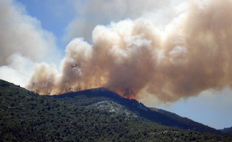
According to ISPRA's monitoring data updated to 28 July 2026, the 2026 wildfire season has intensified significantly across both Europe and Italy. During the second half of July, the area affected by wildfires increased rapidly, particularly in Spain, France and Italy, anticipating the period that is traditionally considered the peak of the fire season between late July and early August. The largest ongoing fires are located in the Spanish provinces of Ávila (more than 440 km²) and Guadalajara (around 330 km²), while in France a major wildfire in the Gironde has already burned more than 400 km² of land.
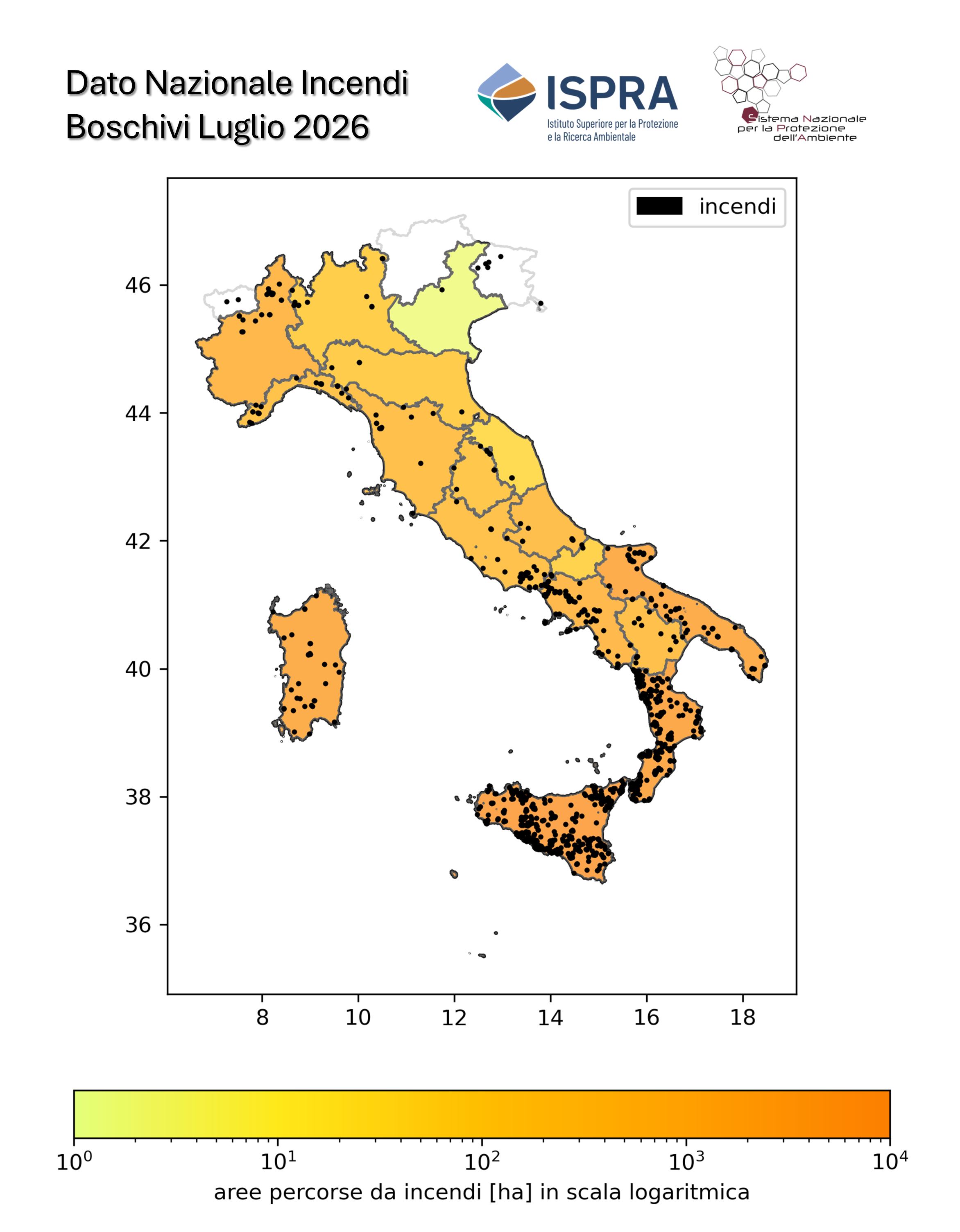
In Italy, from 1 January to 28 July 2026, satellite monitoring detected more than 1,070 large wildfires, affecting approximately 741 km² of land, an area comparable to the entire Province of Lodi. About 14% of the burned area consists of forest ecosystems, while the remaining burned land is mainly permanent grasslands (61%) and agricultural areas (16%). The regions most severely affected are Sicily, Calabria and Apulia, which together account for 73% of the total area burned nationwide. Sicily alone recorded more than 510 km² of burned land, with the most significant event occurring in the Province of Agrigento, where several fire outbreaks affected approximately 67 km².
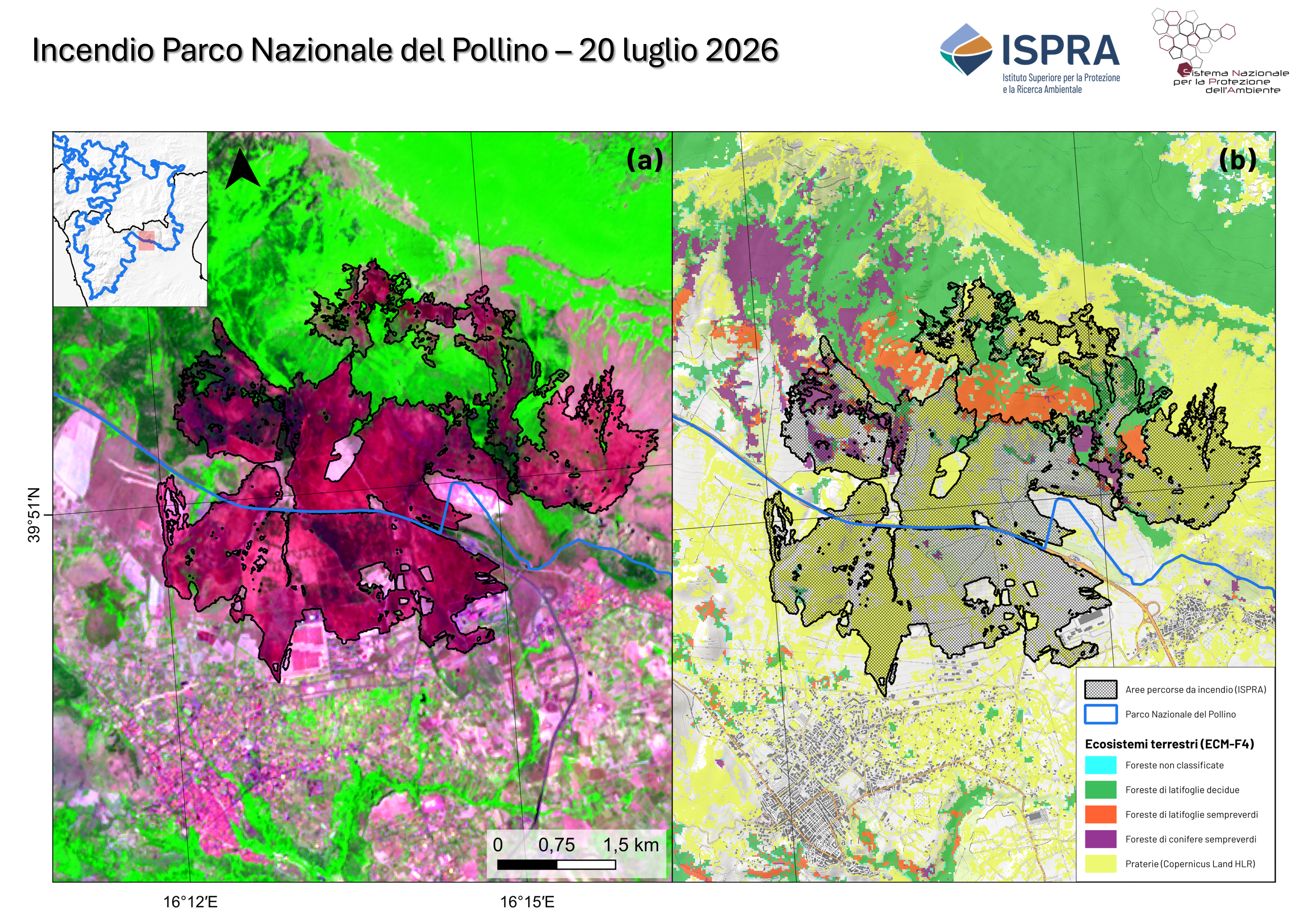
During July, major wildfires also affected protected areas, including Gran Paradiso National Park, where approximately 2.4 km² burned, and Pollino National Park, where a fire affected around 14 km², primarily damaging grasslands, with more limited impacts on forests and Mediterranean shrubland.
The monitoring system developed by ISPRA, based on Copernicus Sentinel-2 satellite imagery and the EFFIS database, provides highly accurate assessments of the extent and impacts of wildfires. Maria Alessandra Gallone, President of ISPRA and the National System for Environmental Protection (SNPA), stressed that scientific knowledge and continuous monitoring are essential tools for guiding environmental protection and ecosystem restoration policies. She also emphasized that prevention remains the most effective weapon against wildfires and requires responsible behaviour from citizens, stronger cooperation among institutions and local communities, and the continued commitment of all organizations involved. Finally, President Gallone expressed her appreciation for the women and men who work every day to prevent, combat and manage wildfires, highlighting that protecting forests is a shared responsibility involving institutions, communities and citizens alike
 |
 |
|
Figure 1 – National distribution of wildfire-burned areas between 1 January and 28 July 2026. The colour gradient from yellow to orange represents, for each Italian region, the cumulative area affected by wildfires. Black dots indicate the locations of the detected fire events. Source: ISPRA – Environmental Monitoring Operations Centre.
|
Figure 2 –Wildfire in Pollino National Park. Panel (a) shows a false-colour image derived from Sentinel-2A data acquired on 25 July 2026. Vegetation is displayed in shades of green, while wildfire-burned areas are highlighted in dark red. Panel (b) shows the wildfire-burned area (black polygon) together with the boundary of Pollino National Park (blue polygon). The figure contains modified Copernicus data processed by ISPRA – Environmental Monitoring Operations Centre. |