Plio-Pleistocene clays along the Adriatic margin
Plio-Pleistocene clays
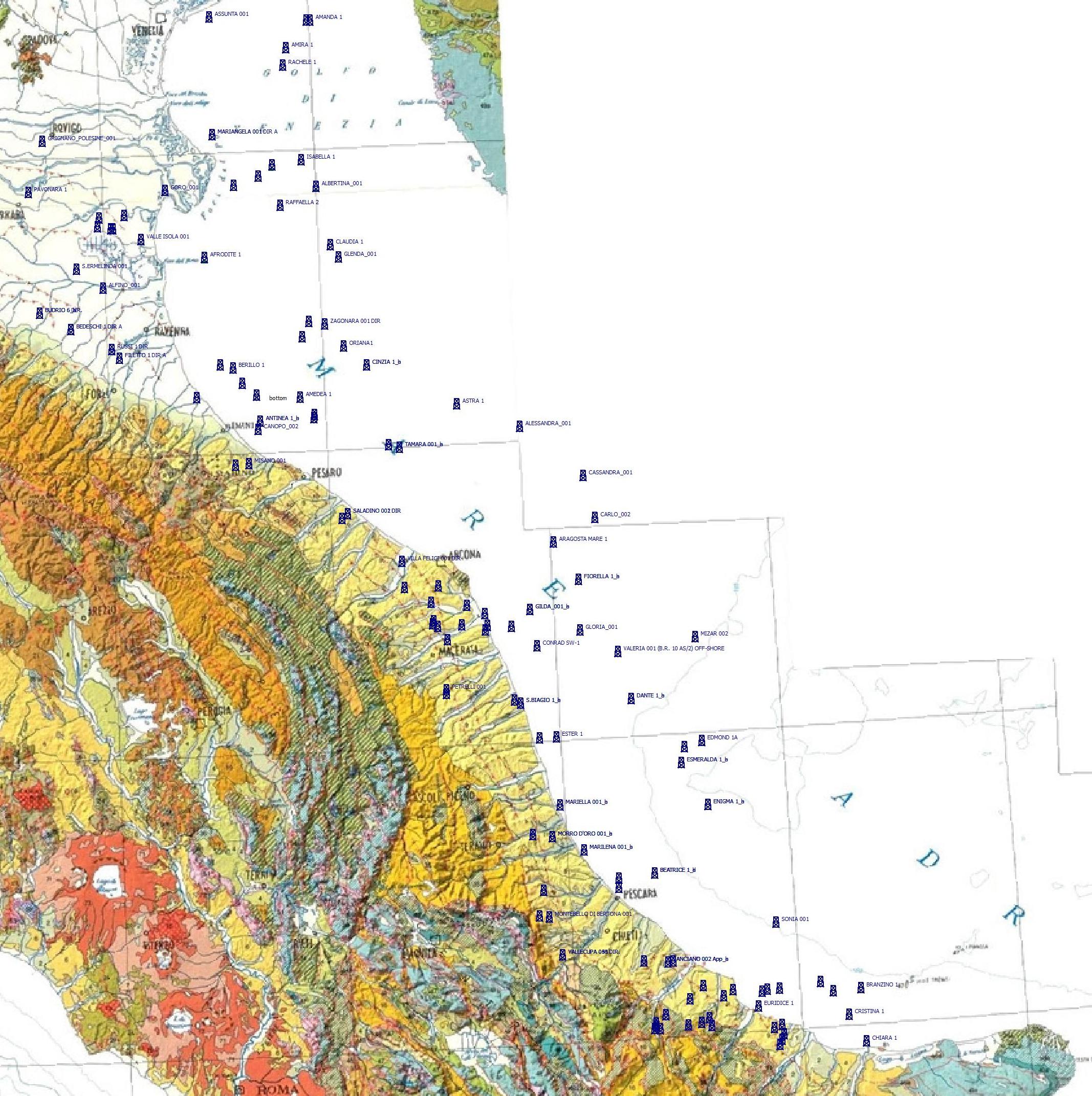 179 deep well stratigraphies (Italian Economic Development Ministry – Ufficio Nazionale per gli Idrocarburi e la Geotermia, wells for hydrocarbon exploration), located along the Adriatic foredeep, have been used as contraints for the 3D reconstruction of the Argille del Santerno volume (cfr. Argille Azzurre, Pliocene inf. p.p. - Pleistocene p.p.).
Only stratigraphic and lithologic data was extracted from the deep well database (http://sgi.isprambiente.it/geoportal/catalog/content/sondaggi.page); however, the original dataset contains more information including description of drilling cuttings, age of lithostratigraphic units, lithology description, attitude, mineralization, depositional environment, porosity, biostratigraphy, and gas percentage, and geophysical logs as, for example, electric potential (mV), resistivity (Ohm m2/m), sonic log (µsec/ft).
First the top and the base boundary surfaces of the Argille del Santerno have been built, using the corresponding depth constraint from each well and comparing it with the nearest ones.
The boundary surfaces have been used to define the volume of the clay deposits along the Adriatic margin.

Moreover two isobath maps for the bottom and the top of the Argille del Santerno unit has been interpolated using the 3D model, together with a thickness map


Similar elaborations will be realized for other regional-wide lithological units.