Geological and geomorphological features of the Island of Pianosa
Introduction
The Geological Survey of Italy (today ISPRA’s Land Protection and Georesources Department) in conjunction with the Department of Earth Sciences of the University of Siena, has started a series of studies and researches on the Island of Pianosa (in the Tuscan archipelago) aimed at its geological and geomorphological characterization.
Indeed, the Island of Pianosa is extremely interesting from a geo-environmental point of view since it remained isolated for a long period of time. Indeed, from the mid 19th century it hosted a penal colony. This preserved the island from human impact quite differently from what occurred in the other islands of the archipelago. All this, guaranteed the conservation of an intact ecosystem, which is quite unique in the Mediterranean. The existence of a penal colony in the past, made the island practicably inaccessible. For this reason, study activities were difficult and limited. The current closing of the prison and concomitant realization of the Parco Nazionale dell'Arcipelago Toscano, have made the island accessible only for study and research activities. The island has no stable inhabitants and there are no hotels. There is a weekly connection with the Island of Elba.
After having obtained access passes by the relevant authorities in charge of the island’s protection and surveillance and after having resolved accommodation logistics, researchers carried out two mapping campaigns in the months of June and September, 2001.
Other interventions were carried out during the course of 2002, aimed at studying and characterizing continental deposits and acquiring more in-depth knowledge of unresolved stratigraphic and geomorphological problems, among other activities.
Geological and geomorphological features
The Island is located in the Tyrrhenian Sea, about 7 miles south of the Island of Elba. It has an area just over 10 sq/km (1,025 hectares). It has a coastal development of 18 km and a morphology which develops mainly in an east-west direction. There is a long and narrow peninsula that extends northwards for about 3 km. The island has a flat calcareous surface with a height of 20-25 m above sea level. The highest point is the location of Belvedere at 29 m. This strip of land is the emerged area of a long sea ridge which connects the Scoglio d'Africa and the Island of Capraia, in a north-south direction.
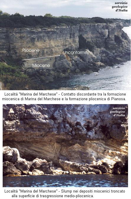
Three different lithostratigraphic units outcrop from the island. These are the formations of Marina del Marchese, Golfo della Botte and Pianosa.
The Marina del Marchese Formation is composed of two different sedimentary units, one dating back to the Lower Miocene and the other to the Upper Miocene. The first belongs to a sea environment while the second to a continental lake one or to a coastal, lagoon/marine environment on top.
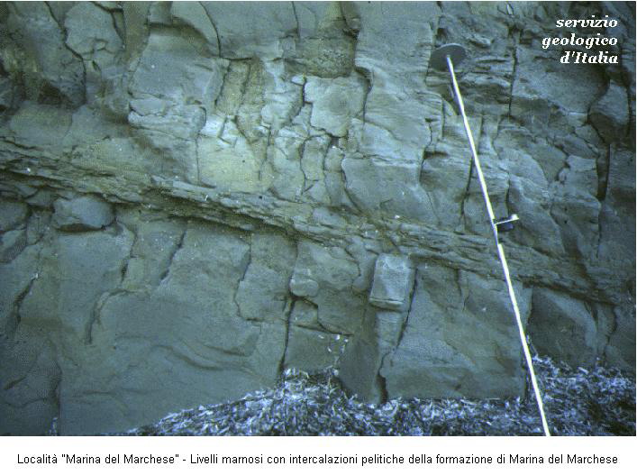
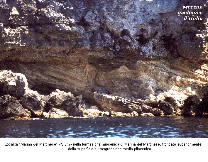
The Marina del Marchese Formation (with an outcropping thickness of about 120 m) is composed of marls with calcarenitic intercalation (of a sea environment) showing clear torbiditic structures. It is characterized by the presence of synsedimentary deformations (slumps). Fossil associations are composed of planktonic and bentonic foraminifera and very rich and diversified calcareous nannofossils. The formation outcrops along the north-western side of the island and dates back to the Burdigalian Age.
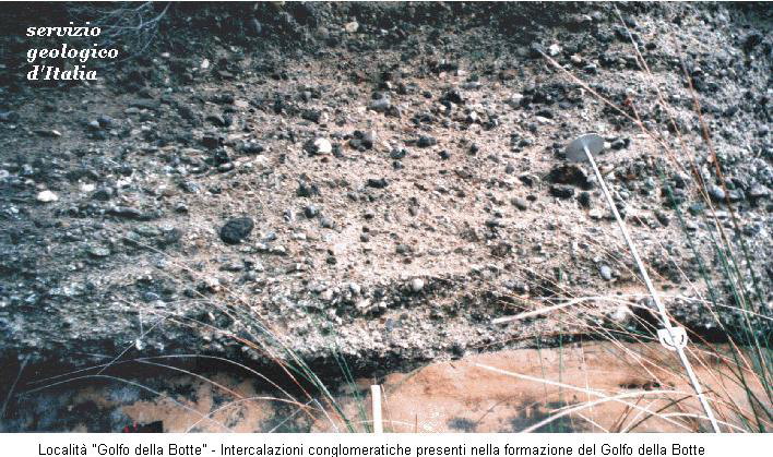
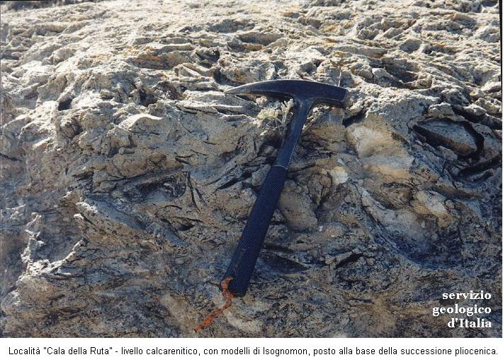
The Golfo della Botte Formation (with an outcropping thickness of about 300 m) is formed of marly clays with strips of dark carbon and arenaceous and conglomeratic intercalations. It was deposited in a transition environment. The formation is characterized by few microfaunas composed of freshwater ostracods, which are only present in some levels. In the higher part there are associations of bentonic foraminifera and ostracods from shallow brackish or marine waters. Many reworked and badly preserved foraminifera were found. The formation is exposed to the base of the Golfo della Botte cliff and to Cala della Ruta and dates back to the Tortonian or Upper Messinian Age (?)
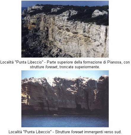
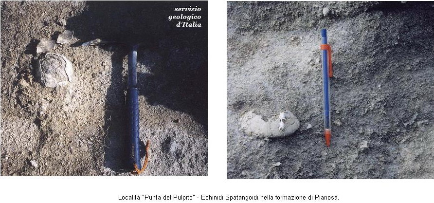
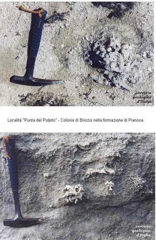
The Pianosa Formation, instead, is composed of organogenic calcarenites and sands. It is extremely rich in macrofossils, mainly represented by bivalvies, gastropods, echinids, bryozoes and calcareous algae. The unit rests with some unconformity on the Miocenic formations of Marina del Marchese and Golfo della Botte and has a thickness of about 30 metres. In the higher part, mainly in the south-western part, there are dipping foreset beds. The basal part of the formation dates back to Middle Pliocene Age while the current analyses that are in course seem to indicate a more recent age for the higher part.
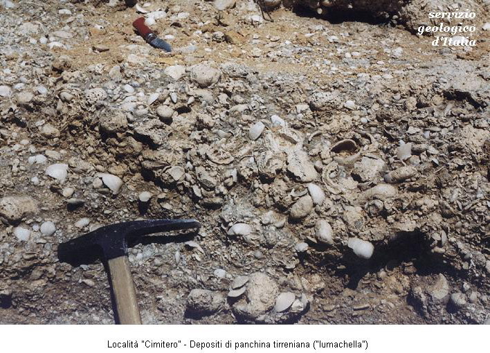
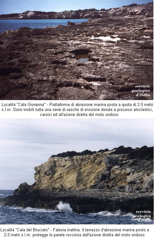
On top of the formation there are also Pleistocene deposits of different nature. Locally, there is an outcrop of whitish calcarenites rich in gastropods and bivalves (including Strombus bubonius, Conus testudinarius, Polinices lacteus and Patella ferruginea) as well as bryozoes and calcareous algae. This unit has a thickness of 120 cm and, due to its fossil content, is attributed to the Upper Pleistocene (Tyrrhenian a.s.l.). It was found up to the height of 8 metres above sea level and associated to the presence of abrasion platforms and tidal notches. It provides useful indications on the eustatic movements that involved the area.
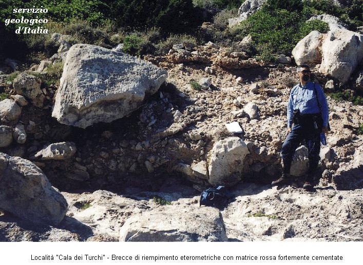
Continental deposits are then found.
These are composed of breccias, red and yellow sands and silts. Their chronological and genetic characterization is being studied.
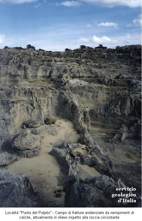
Large fields of fractures are found on the island. These are mainly vertical and at times tilted and filled with calcite.
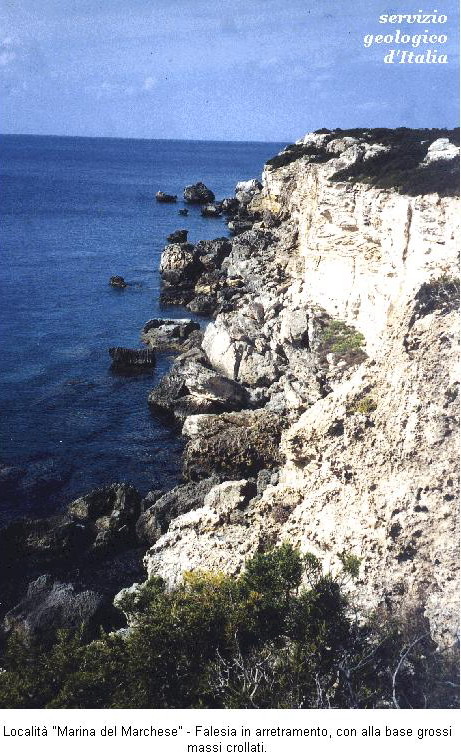
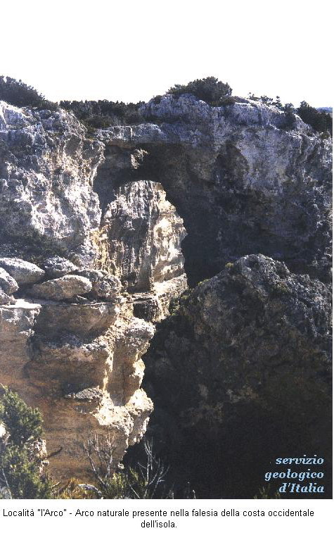
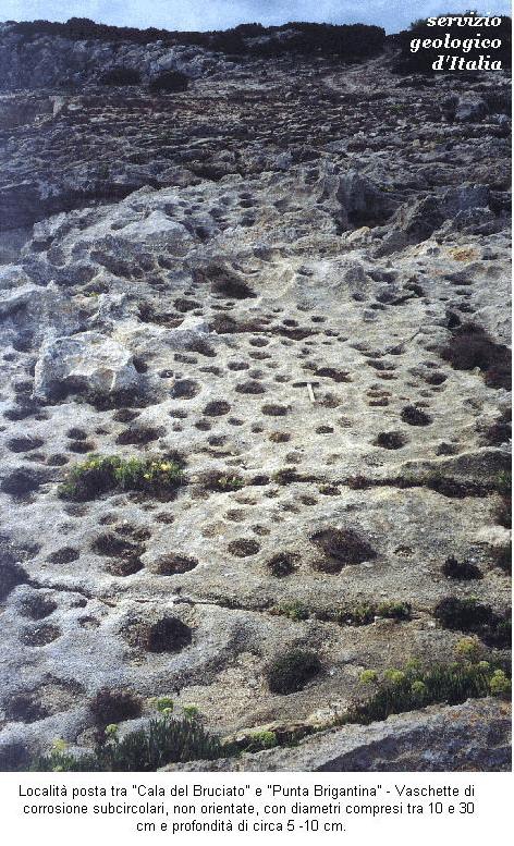
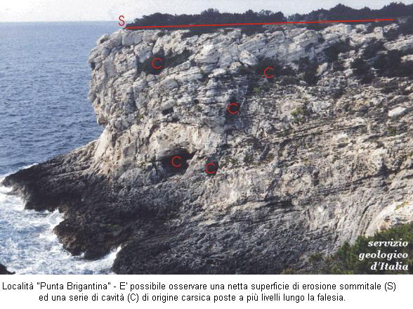
The island’s geomorphological context is strongly influenced by coastal erosion processes which produce many types of forms such as: cliffs, abrasion platforms, potholes, tidal notches, arcs, caves, isolated rocks, etc. These contribute to creating a unique landscape of its kind, which has still preserved itself from the amending action of human activities. When evaluating the modelling process, it should be noted that the Karstic process had quite an important role and it is manifested all over the island with magnificent epigean forms (corrosion basins, grooves and furrows) and a considerable development of hypogean forms (conduits, caves, galleries with a horizontal and vertical development).
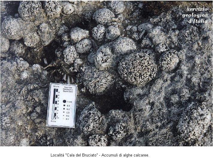
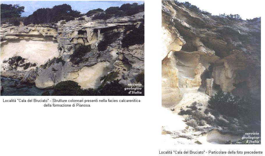
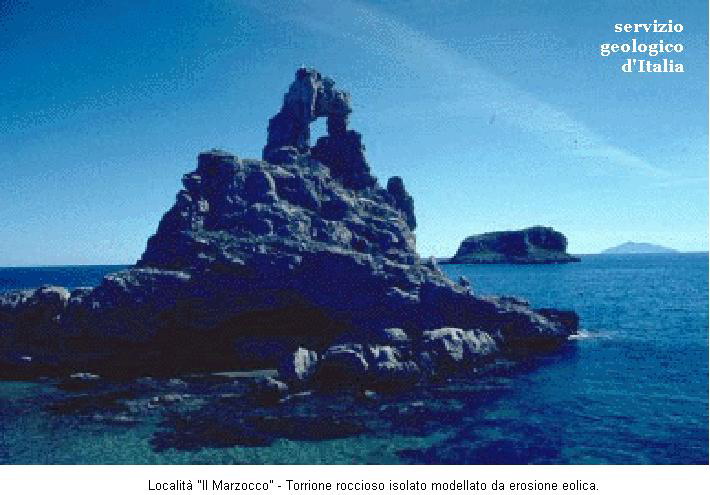
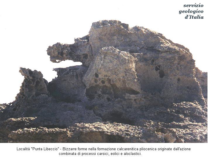
Of particular interest are also unusual forms related to subaerial erosion existing at Cala del Bruciato, at Marzocco and at Punta Libeccio.