Istituto Superiore per la Protezione
e la Ricerca Ambientale

Cerca
Urban Heat Islands: Reforestation and Depaving Can Reduce Temperatures by Up to 4°C
Jul 08, 2026

Urban Heat Islands: Reforestation and Depaving Can Reduce Temperatures by Up to 4°C

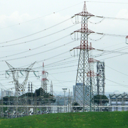
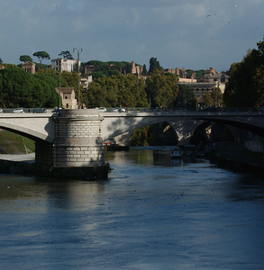
The MIRIFICUS project, coordinated by the Italian National Research Council (CNR-IBE) in collaboration with ISPRA and supported by the Italian Space Agency, shows that urban heat can be significantly reduced through nature-based solutions. Simulations carried out in Rome and Florence demonstrate that increasing green spaces, planting trees, and replacing heat-retaining pavements with cooler surfaces can lower daytime temperatures by more than 4°C, while maintaining an average daily reduction of about 2–2.2°C.

The project also analyzed satellite data collected between 2013 and 2023, revealing that most Italian cities experience summer surface temperatures above 40°C because of extensive asphalt, concrete, and limited vegetation. In contrast, surrounding rural areas are considerably cooler. The study highlights that urban design—including building density, height, and construction materials—plays a major role in determining local temperatures. For example, industrial areas in Rome can reach 57.2°C, whereas urban forests in Florence are almost 9°C cooler than densely built neighborhoods.

To support urban planning, MIRIFICUS has developed a free webGIS platform and a Google Earth Engine web application that allow municipalities to analyze local temperature patterns, assess the effects of land use and green spaces, and simulate the impact of mitigation measures. According to the project partners, these tools provide scientific support for designing more resilient, healthier, and climate-adapted cities.

Project MIRIFICUS

Download data of Italian Municipalities

Highlight

Topics in evidence

International Day of the Mediterranean Sea
Jul 08, 2026 — Jul 08, 2026

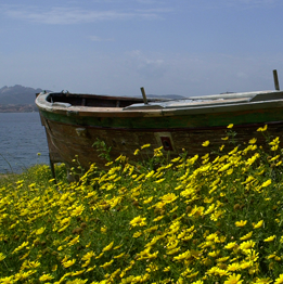
The Mediterranean is a sea of extraordinary natural beauty, history, and culture that deserves to be protected and enhanced. Its unique heritage is celebrated each year on 8 July with the International Day of the Mediterranean Sea. Through the MER Project (Marine Ecosystem Restoration), funded under Italy's National Recovery and Resilience Plan (PNRR), ISPRA is developing a comprehensive initiative to map, restore, and protect one of the world's richest—and most fragile—marine ecosystems. The project's goal is to safeguard the Mediterranean's biodiversity and preserve it for future generations. The MER Project, the largest marine initiative within the National Recovery and Resilience Plan, is led by the Italian Ministry of the Environment and Energy Security (MASE) as the responsible authority, with ISPRA acting as the sole implementing body. The project comprises 37 lines of activity to be carried out across the entire national territory and is structured around three main pillars: the restoration and protection of the seabed, the strengthening of marine and coastal observing systems, and the mapping of coastal and marine habitats of conservation interest.


continue
CII500K – The New Hydrogeological Map of Italy’s Groundwater
Jul 10, 2026 09:00 AM — Jul 10, 2026 04:30 PM Roma, Auditorium MASE “Ilaria Alpi e Miran Hrovatin”, via Capitan Bavastro 182

The Blue Gold of Our Country

In Italy, we drink groundwater: more than 84% of the country’s civil water demand is supplied by spring water or water extracted from underground aquifers through wells.
A true “Blue Gold” resource that is renewed every year and must be understood, protected, and enhanced.

These needs are addressed by the new Hydrogeological Map of Italy at a scale of 1:500,000 (CII500K), which, after being presented to the scientific community, will be officially presented to the public on June 9 during an event at the Auditorium of the Ministry for the Environment and Energy Security.

The event will provide an opportunity to illustrate how the map was developed and to showcase the wealth of information it contains. The project was coordinated by ISPRA and the “Ardito Desio” Department of Earth Sciences at the University of Milan, in collaboration with ISTAT, CMCC (Euro-Mediterranean Center on Climate Change), and the seven District Basin Authorities, as well as with the participation of the wider groundwater expert community: Regions and Autonomous Provinces, ARPA/APPA environmental agencies, universities, research institutions, and professional associations. This initiative represents the first example of “participatory cartography” in Italy.

Program

Map of Italy at a scale of 1:500,000

continue
PNNR MER: Seamounts and deep species
Mar 23, 2026

In the depths of the Mediterranean Sea, at over 2,000 meters below the surface, seamounts reveal a world that until recently we were unable to see. Thanks to a Work Class ROV (Remotely Operated Vehicle)—used as part of the PNRR MER project—a true “robotic vehicle,” research by ISPRA is able to enter these environments and closely observe the species that inhabit them: fish, crustaceans, cephalopods, and cartilaginous fish.

In extreme conditions, life finds surprising solutions, such as large eyes, wide mouths, large body sizes, or long fins used like a tripod, creating shapes and behaviors that tell the story of the strength of these mysterious ecosystems.

continue
All ISPRA Events All News