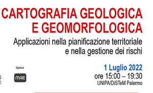
Geological and geomorphological cartography - Applications in territorial planning and risk management
The conference includes two sessions that will deal with the new geological cartography of the CARG project and the interpretations and practical applications, the SUFRA project (FRana susceptibility) for the realization of maps of landslide susceptibility at various scales, using the data of the new geological maps ( CARG), the landslide inventory (IFFI) and the PAI archive.
The second session will deal with the issues of updating the PAI with related applications on the classification, evolution and monitoring of landslides and the actions to safeguard the territory for risk management.
- https://www.isprambiente.gov.it/en/archive/news-and-other-events/ispra-news/2022/06/geological-and-geomorphological-cartography-applications
- Geological and geomorphological cartography - Applications in territorial planning and risk management
- 2022-07-01T15:00:00+00:00
- 2022-07-01T19:30:00+00:00
- The conference includes two sessions that will deal with the new geological cartography of the CARG project and the interpretations and practical applications, the SUFRA project (FRana susceptibility) for the realization of maps of landslide susceptibility at various scales, using the data of the new geological maps ( CARG), the landslide inventory (IFFI) and the PAI archive. The second session will deal with the issues of updating the PAI with related applications on the classification, evolution and monitoring of landslides and the actions to safeguard the territory for risk management.
- When Jul 01, 2022 from 03:00 PM to 07:30 PM (GMT+0 / UTC0)
- Where Palermo/Online
-
Add event to calendar
iCal
ISPRA will participate at the meeting

